Space: Swot, a major Franco-American satellite for managing the planet’s water resources
Launched Dec. 15, the mission, led by Cnes and NASA, will map nearly all of Earth’s surface water. And by repeating its work every three weeks to allow accurate follow-up of its development.
Climate, meteorology, environment and geology: Earth observation satellites have become crucial in understanding and monitoring terrestrial phenomena. The Franco-American Swot mission, which concludes the space year, will make this clear again on one of the most sensitive, complex, and crucial topics: water.
Launch a program # SWOT task Due now on December 15th?
? We’ll be live following the launch with you and getting you to discover this satellite
? Articles, news and latest updates running https://t.co/9rdIDMmW6c https://t.co/h8wWTkR3SM– CNES (CNES) December 1, 2022
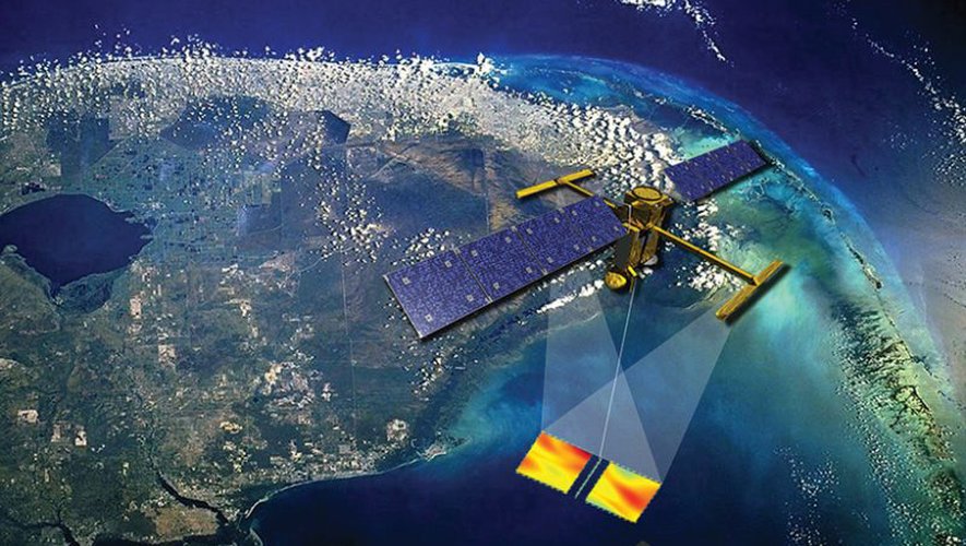
On December 15 at 12:47 pm, a Falcon 9 rocket loaded with a Franco-American gem will take off from Vandenberg Air Force Base in California, whose task will be to survey the surface waters of almost the entire globe. measurements “Unpublished” of its sophistication and quantity thanks to a tool unmatched today. Swot will make it possible to create 3D map of water surfaces.explains Thierry Lafont, project manager at the National Center for Space Studies (Cnes). World ocean map “With scales ranging from 10 km to 100 km we have not been able to reach it so far.”And lakes with sides 250 meters long and rivers 50 meters wide or more, continues Pascal Olter Girard, deputy director of strategy at the French Agency. “We’ll measure their topography, their slope, which will give us their flow.”
The heart of French Swot
With a value of 1.2 billion euros and a theoretical duration of 42 months – in reality it should stretch over five to ten years – this mission is the result of Franco-American cooperation in up to a third to France, and the rest to NASA. the first “in charge of the satellite”explains Thierry Laffon, a platform manufactured by Thales-Alenia Space. The second designed the payload, KaRIn, which “The heart, the radar, is also French.”. The mission center is still located in Toulouse, which will receive 8 billion bits of data daily for processing.
Swot will do a large scale interferometric altimeter. the satellite “It will emit a radar signal that will be reflected on the ground and received by two antennas, which will make it possible to accurately determine the height of the surface in question.”. Instead of the usual bearings vertically, it will act on a width of about 120 km, ie “the entire surface of the planet” Within 21 days, this stock is replenished by 90% of surface water every three weeks.
set of applications
The issues are many. Scientists: We’re going to take a look at the water cyclePascal-Oltre-Girard continues the quest In order to better understand what is happening at the watershed and estuarine level at the interface between rivers, rivers and seas “, or ocean dynamics critical to climate change. them too “Climatic and Societal: Flood Impact Study, Seasonal Surface Water Stock Assessment, Irrigation Resources Estimation, River Navigation, Hydropower, etc.”.
You’ve Never Seen This Before: Simultaneous Deployment of Two Satellite Solar Panels in Flight Configuration – Here’s a SWOT in the Clean Rooms at @employee. a task @employee – @employee
with contributions @employee @employee Which will revolutionize the science of hydrology. pic.twitter.com/9WvCKDNNv7– CNES (CNES) January 28, 2022
The applications are large, for sea state forecasting, seasonal weather forecasts – which are affected by the oceans – and management of freshwater resources, ocean level monitoring, and flood and flood prevention. A non-exhaustive list of a tool expected by many agencies, IRD, Météo France or Inrae, in France alone, and 1,500 researchers around the world.

The main characters of the Swot mission.

“Organizer. Social media geek. General communicator. Bacon scholar. Proud pop culture trailblazer.”
