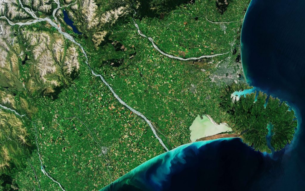
New Zealand, Banks Peninsula, satellite imagery
European Space Agency (ESA), as part of the “Earth from Space” program and with the help of satellites that are part of the mission Copernicus Sentinel, spread another, wonderful, click Coming from space, this time in relation to the Banks Peninsula, a peninsula of volcanic origin located on the east coast of the South Island, the largest of the two major islands that make up New Zealand.
A region of volcanic origin
deepen
Vandenberg Air Force Base, California, imaged by satellite
In the snapshot obtained on January 4, 2019, the European Space Agency shows that the Banks Peninsula is visible in the lower right part of the image. The region consists of two superimposed extinct volcanoes, namely Vulcano Littleton and Akaroa Volcano. It is a region that arose as a result of numerous volcanic eruptions that occurred about eight million years ago. The peninsula also contains many bays and other small inlets, giving it an “unusual cogwheel appearance”. Christchurch is the largest city in the South Island and can be seen precisely north of the Banks Peninsula. experts, in press release Appeared on the official website, then they said that the name of the peninsula precisely is associated with Sir Joseph Banks, a British biologist who sailed with Captain Cook.
picture description
Another area of the photographed area Satellites are those in the Canterbury plains. It is a part of the peninsula that extends 80 kilometers inland, from the coast to the southern foothills of the Alps, and can be seen in the upper and left part of the image. As experts say, these plains represent a rich agricultural area where the production of wheat and barley is very active, as well as being known for raising wool and livestock. Rangitata, Rakaia, and Waimakariri, on the other hand, are rivers The main regions are shown in the image as they flow southeast of the Southern Alps. In particular, the Rakia River, recognizable in the center of the image, is one of the largest intertwined rivers in New Zealand and stretches for 150 kilometers before diving into the Pacific Ocean. Between this waterway and the Banks Peninsula, Ellesmere Lake was born, and is currently recognizable as a low coastal lake, with an emerald green colour, probably due to the high concentration of chlorophyll. Finally, commenting on the photo, experts still explain that the long strip of land, visible in brown south of the lake, represents the Kaitorete Spit, a barrier separating the lake from the lake.The Pacific Ocean.

“Reader. Travel maven. Student. Passionate tv junkie. Internet ninja. Twitter advocate. Web nerd. Bacon buff.”
